Map room
Find a map or geospatial dataset of the North, First Nations, Inuit and Metis communities or programs for Indigenous communities. The maps are available as web-based interactive maps or static maps that can be downloaded and printed.
For additional map formats, please contact servicesgeomatiques-geomaticsservices@sac-isc.gc.ca.
Featured maps
First Nations and Inuit communities in Canada
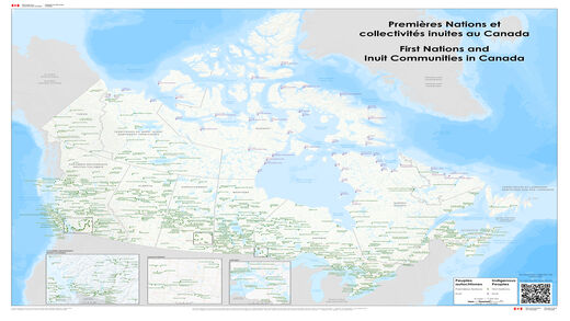
These maps and geospatial datasets show the geographic location of First Nations and Inuit communities.
Aboriginal and Treaty Rights Information System (ATRIS)
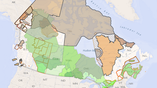
ATRIS is an Internet-based mapping interface to display the location of Indigenous communities and information on their established and potential Aboriginal and treaty rights.
Indigenous community infrastructure map

In line with the Government of Canada’s commitment to transparency, this map, shows projects supported in part or in whole by ISC targeted infrastructure funding. The communities linked to these projects on the map are First Nations, Tribal Councils or other Indigenous organizations that have received project funds and/or are intended users of these projects.
Explore maps and data
Filter maps
Filter maps
| Group | Category | Maps | Type |
|---|---|---|---|
| Indigenous Peoples |
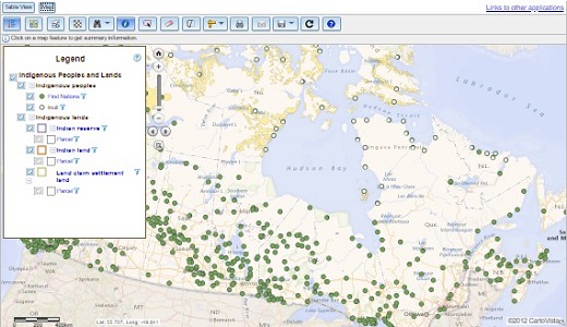
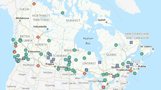
Indigenous Community GeoViewerThis interactive map application shows First Nation, Inuit Community and Tribal Council locations along with other departmental geographic data. The application includes viewing, searching, measuring, adding, sharing and printing tools.
|
Interactive Map, Data | |
| Indigenous Peoples |
First Nation Profiles Interactive MapThis interactive map shows a collection of information that describes individual First Nation communities across Canada.
|
Interactive Map, Data | |
| Indigenous Peoples |
First Nations and Inuit communities in CanadaThese maps and geospatial datasets show the geographic location of First Nations and Inuit communities.
|
Static Map, Data | |
| Indigenous Lands, Other Government Departments |

Aboriginal Lands and RegistriesAccess data and map applications for the Indian Lands Registry and Aboriginal Lands of Canada including the legislative boundaries of Indian Reserves, Land Claim Settlement Lands.
|
Interactive Map, Data | |
| Indigenous Peoples, Indigenous Lands, The North |
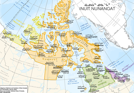
Inuit NunangatThe Inuit Nunangat represents all 51 inhabited and serviced Inuit communities living on four Inuit regions across the northern Canada. Explore and learn about their location, traditional name, population and other information.
|
Static Map, Data | |
| Indigenous Peoples |
Indian Residential Schools Interactive MapThe Indian Residential Schools Interactive Map allows users to visualize the location of the 140 former residential school sites recognized in the Indian Residential Schools Settlement Agreement as well as provide information on the current status and historical context of the site. |
Interactive Map | |
| Indigenous Lands |
Aboriginal and Treaty Rights Information System (ATRIS)The Aboriginal and Treaty Rights Information System (ATRIS) is an Internet-based mapping interface to display the location of Aboriginal communities and public information on their established and potential Aboriginal and treaty rights.
|
Interactive Map, Data | |
| Indigenous Lands |
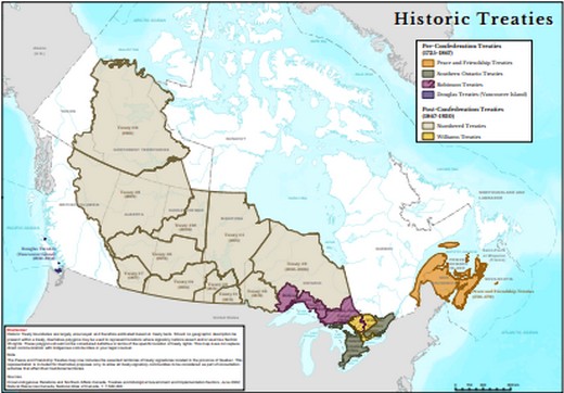
Historic TreatiesThis map illustrates the boundaries of historic treaties concluded between First Nations and the British and Canadian governments from 1701 to 1930.
|
Static Map, Data | |
| Indigenous Lands |

Modern treatiesThis map illustrates the boundaries of all finalized modern treaties between Indigenous communities and the Canadian government.
|
Static Map, Data | |
| Indigenous Lands |

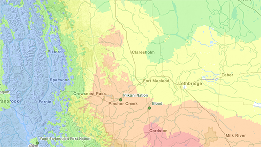
British Columbia - Treaty negotiationsThis map shows the approximate traditional territories of the First Nations which entered the British Columbia Treaty Process, as described in their statements of intent to negotiate a treaty. It also shows the areas in which Final Agreements are completed and in effect.
|
Static Map, Data | |
| Indigenous Lands |
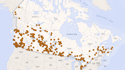
Specific Claim SettlementsThe Government of Canada has a policy and process in place for resolving specific claims through negotiations. Explore to learn about specific claims settled through negotiations with First Nations since 1973. |
Interactive Map | |
| Emergency, Health and Wellness |
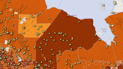
Community Well-Being indexThese maps show the Community Well-Being (CWB) Index scores for Indigenous communities in Canada. The CWB is a method of assessing socio-economic well-being in Canadian communities. Various indicators of socio-economic well-being, including education, labour force activity, income and housing, are derived from Statistics Canada's Census of Population and combined to give each community a well-being "score".
|
Interactive Map, Static Map, Data | |
| Infrastructure and Clean Drinking Water |
Indigenous community infrastructure mapIn line with the Government of Canada’s commitment to transparency, this map, shows projects supported in part or in whole by ISC targeted infrastructure funding. The communities linked to these projects on the map are First Nations, Tribal Councils or other Indigenous organizations that have received project funds and/or are intended users of these projects.
|
Interactive Map, Data | |
| Indigenous Peoples |

Education and First NationsThis map shows elementary and secondary schools and programs administered by First Nations and located on reserve.
|
Static Map, Data | |
| Emergency, Health and Wellness |
Cultural Spaces in Indigenous Communities ProgramThis map shows the location of the Cultural Spaces in Indigenous Communities Program (CSICP) projects as well as some attributes related to the projects. |
Interactive Map | |
| Emergency, Health and Wellness |
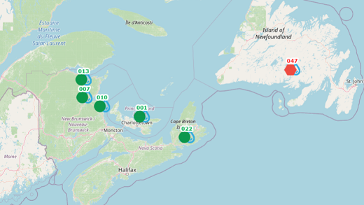
Wildfire risk and Indigenous communitiesThis map shows the locations of Indigenous communities and their proximity to recent wildfires. |
Interactive Map | |
| Infrastructure and Clean Drinking Water |
Map of long-term drinking water advisories on public systems on reservesThis map shows lifted and active long-term drinking water advisories on public systems on reserves across Canada.
|
Interactive Map | |
| The North |
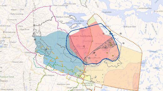
Northwest Territories - GeoViewerThis map is a reference tool intended to help representatives from governments, Indigenous organizations, industry, regulatory bodies, as well as any other interested person, understand Indigenous rights and interests in the Northwest Territories. Interactive maps, static maps, story mapInteractive mapsNote: It is possible to view Government of the Northwest Territories (GNWT) layers related to land/mineral tenure within the NT GeoViewer. To do so, use the "Add/Remove Layer(s)" button and add the "Available Layers", GNWT Planning Cadastre (for land tenure) and/or GNWT Economy (for mineral tenure). Static maps
Story map |
Interactive Map, Static Map, Story Map | |
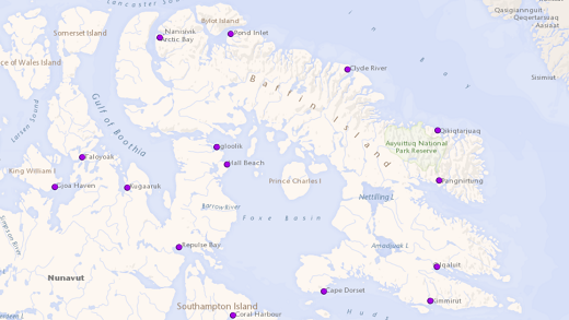
| The North |

Nunavut - Map ViewerThis map viewer displays the mineral rights spatial data that is maintained by Crown-Indigenous Relations and Northern Affairs Canada (CIRNAC) as well as several datasets prepared and maintained by other data custodians that are useful to CIRNAC clients.
|
Interactive Map, Data | |
| The North, Emergency, Health and Wellness |
Nutrition North CanadaNutrition North Canada (NNC) is a Government of Canada program that helps make nutritious food and some essential items more affordable and more accessible.
|
Interactive Map, Static Map | |
| The North, Other Government Departments |
Indigenous mining agreementsOver the last few decades, Aboriginal-industry relationships and partnerships have evolved tremendously through the conclusion of various types of agreements related to mine development that have proven to be successful in securing benefits for many Indigenous communities.
|
Interactive Map, Data | |
| Indigenous Peoples, Other Government Departments |
Indigenous Geographical NamesThe Indigenous Geographical Names dataset presents an extract from the Canadian Geographical Names Data Base (CGNDB) of geographical names with roots in Indigenous cultures.
|
Data, Story Map |